


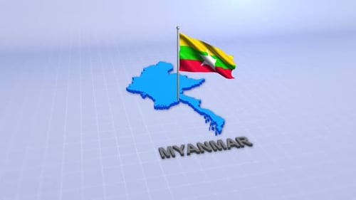
Animated 3D Myanmar Map with Flag Reveal
By meshgrid- Length
- 0:15
- Resolution
- 1920 x 1080
- File Size
- 8.63 MB
- Frame Rate
- 29.97 fps
- Alpha Channel
- No
- Looped
- No
- Video Encoding
- H.264
- Orientation
- Horizontal
- Commercial License
- Further Information
Description
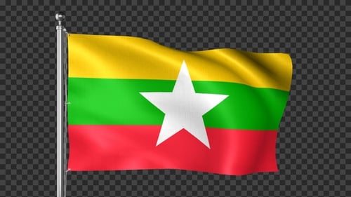
This animated clip presents a dynamic 3D map of Myanmar, featuring its national flag gracefully revealing within the country's borders. The map rotates subtly, offering different perspectives, while the name 'MYANMAR' appears as a distinct 3D text element below. The background consists of a modern digital data network, with glowing dots and connecting lines subtly moving, adding a technological and informative ambiance. This visual effect is clean, professional, and contemporary, using a soft color palette that highlights the flag's vibrant colors. It serves as an excellent visual asset for corporate presentations, news broadcasts, educational content on geography, or travel documentaries. The animation is designed to enhance global communication, offering an engaging way to introduce or highlight Myanmar within a larger project, maintaining a sophisticated and modern aesthetic throughout.


Animated 3D Myanmar Map with Flag Reveal by meshgrid